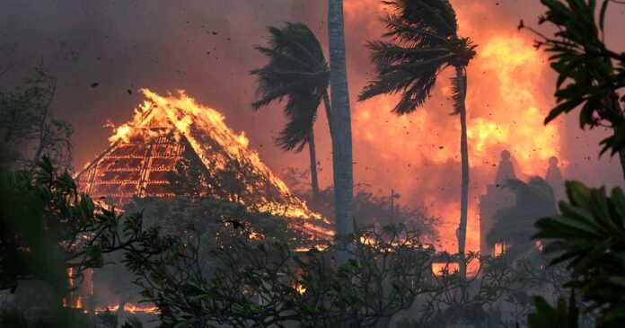
Wildfires driven by Hurricane Dora’s strong winds swept through Maui and Lahaina in Hawaii, destroying historic structures, causing evacuations, and resulting in a death toll of at least 36
The devastating effects of wildfires that tore through beautiful Hawaiian islands and destroyed a historic town, resulting in multiple deaths and evacuations can be seen in maps of Maui and Lahaina today.
At least 36 people have died, with the death toll expected to rise as search-and-rescue teams scour charred areas. The fires have caused widespread devastation, damaging or destroying over 271 structures.
The maps of the destroyed areas illustrate the agonising hours that people endured during this major catastrophe. The fires were driven by strong winds from Hurricane Dora passing south of the island chain, knocking out power and grounding firefighting helicopters.
The president has promised federal assistance, deploying resources including the Coast Guard, Navy, Marines, and National Guard to aid in firefighting and rescue efforts.


