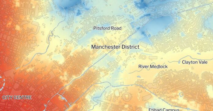
New heat maps clearly show the difference in temperature between areas with more greenery in five English cities during the UK’s hottest day on record a year ago today
Areas with fewer trees and less green spaces are up to 5C warmer during the UK’s hottest days, heat maps have shown.
Heat maps show the the temperature variation in five English cities – London, Birmingham, Manchester, Bristol and Newcastle – during the UK’s hottest day on record a year ago today.
The analysis, from mapping experts TerraSulis and environmental group Friends Of The Earth, found that neighbourhoods with higher levels of tree cover, green space or both were much cooler than those without.
It is the first time research on the cooling abilities of green spaces and trees in built-up areas has been modelled, according to FOE – with maps showing the hottest areas appearing in dark red and the coolest, most nature-dense in light blue.


