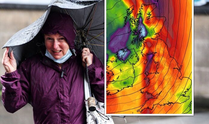
This autumn has now officially made history thanks to an unseasonably mild weekend which saw the hottest Remembrance Sunday in the UK on record. But that might be about to change as the delayed adverse weather conditions make their way across Britain this week. With December fast approaching, many have wondered whether the festive season may be plagued by more warm conditions – but it appears the second-half of November is set to bring wind, rain, fog and frost onto the horizon. Jim Dale, senior meteorologist at British Weather Services has detailed to Express.co.uk how the turn in conditions begins this week.He said: “Yes it will be colder but really only back to the seasonal averages. A bit of snow for the Scottish tops but probably not much more. The rain or showers will be on and off. Some heavy rain to pour with the middle of week Wednesday into early Thursday looking poor with wind and rain. It’s kind of normal seasonal stuff but it could produce warnings.”He warned winds this week could peak at around 50mph. Brian Gaze, The Weather Outlook’s founder, also warned an unsettled week is on its way, with this morning’s fog warning marking the start of truly winter-like conditions.In his blog he wrote: “Wednesday starts dry in much of the UK, although there could be showers in the north west. During the second half of the day heavy outbreaks of rain and strong winds push northeastwards across southern and central regions. Gales are likely in western and southern coastal counties. The north probably remains mostly dry.”Thursday may start with outbreaks of rain in the north but they should clear to leave a mix of sunshine and showers in all regions. Locations in central and eastern England have the best chance of remaining dry. The rest of the week is forecast to be unsettled. Significant day to day variation is expected, but all regions probably have rain and strong winds at times.” The weather is on the downward spiral after a warm autumn so far (Image: WX CHARTS/ Getty) A relentless pattern of rain comes this week (Image: WX CHARTS)And it appears the Met Office’s long-range forecast shows that mild temperatures may truly be a thing of the past, as the rest of November has a bleak outlook with much more rain to come. Its outlook from this Friday to November 27 adds: “Friday is likely characterised mainly by showers interspersed with clear, sunny intervals, with the west probably seeing the heaviest showers, perhaps with some prolonged rainfall here.”The east possibly staying mostly dry in places through the day. Unsettled weather likely to remain over the weekend, perhaps with the northwest seeing the wettest conditions, possibly windy for many with a chance of gales, especially in the west.”These unsettled conditions are likely to remain through most of the week, however there is a chance of some short lived high pressure to start the week, bringing a low risk of patchy frost by night in the north. Rain and strong winds likely over the second weekend, especially in the west. Temperatures possibly slightly above average initially but returning closer to average later.”READ MORE: BBC Weather: Dense foggy mild conditions forecasted for regions UK Continual rain is predicted for much of the UK (Image: WX CHARTS) Icy temperatures are set to follow and remain now as winter sets in (Image: WX CHARTS)WX Charts, an indicative weather model, shows on its maps a strong band of rain moving across Northern Ireland and much of the UK by 6am tomorrow (Tuesday) in a pattern that keeps reoccurring for at least 10 days. The rain pushes in off the Atlantic and heads eastwards, and, just when it looks to push further across Europe another rain-filled weather front develops again in the west.Temperatures surprisingly remain steady at around 9C for much of England until at least this Saturday when the mercury takes its first dip to around 2C in the south and 1C in the north. In southern Scotland thermometers will struggle to get above freezing by noon. Looking ahead to next week temperatures will recover slightly, but a new norm will be on the cards of about 4C average which coincides with longer range forecasts predicting more chillier fronts for the UK. DON’T MISS:Ex-Trump aide warns ‘Democrats going to regret’ a Biden 2024 rerun [REPORT] ‘Time for Republicans to end the Trump purgatory and begin new era’ [REPORT] Biden warned Democrat plans will be ‘dead on arrival’ [REPORT]Speaking to Express.co.uk Mr Dale explained how this autumnal weather is more than likely here to stay throughout December. He said: “It normally does and before we end November a snow covering is expected for the same higher mountains.”The difference in December is that temperatures will feel far colder, as the Met Office has already said more ‘settled’ weather is on its way, which usually means there will be a cold chill in the air. In its outlook for the first 12 days of December it adds: “Into this period conditions will possibly become more settled as high pressure moves over the UK. This should bring drier and calmer weather than that of late.”However, shorter periods of unsettled weather are still possible. Temperatures likely to fall back to average, perhaps below average at times, especially by night, with an increased risk of fog.”
Bitterly cold 50mph winds and torrential rain hammers Britain in days
Sourceexpress.co.uk
RELATED ARTICLES


