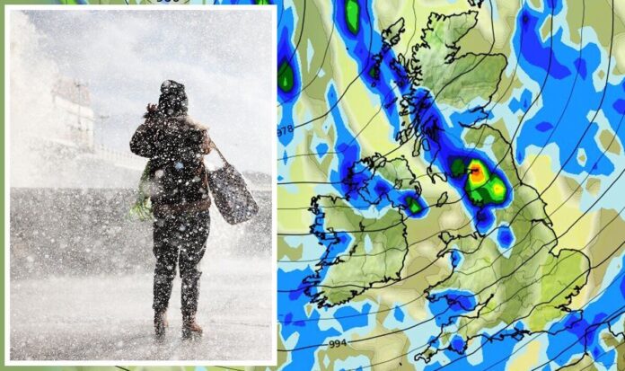
One forecaster is warning of potential flash flooding in some areas later tonight as a “deeply cyclonic” south westerly weather flow begins to sweep across the UK. Netweather expert Nick Finnis has predicted stormy conditions will come from the north east, hitting the north west and parts of the south west in hours. He said the risk of flooding will affect the “already saturated ground” in places which have already been lashed with rain. Meanwhile, the Met Office is offering a tale of two halves for the UK – with eastern, and the north eastern regions escaping the wrath with “clear spells and perhaps a passing shower.”Its forecast for this evening adds: “Some inland, eastern and northeastern areas becoming largely dry with clear spells, perhaps just a passing shower. Exposed southern and western coastal counties still seeing more frequent, sometimes heavier showers.”Mr Finnis explained his verdict in detail, and added: “Thunderstorms may produce hail and gusty winds, showers and storms will be most frequent towards southern and western coasts – so here there is also a risk of localised flooding – given already saturated ground. Showers and storms will continue towards southern and western coasts overnight.”Brian Gaze, founder of The Weather Outlook, has blamed the unsettled period the UK seems to be battling on a low pressure system centred to the south of Iceland – and it’s set to cause a bit more disruption for the “next couple of days”, he said.”However, high pressure will be building from the southeast during the middle of the week and it heralds a change,” he added. “Temperatures climb and we go from mild to exceptionally mild conditions. Also, rain increasingly becomes restricted to the north west.” Weather charts show a band of heavy rain will push eastwards (Image: WX CHARTS/Getty) Heavy rain will relentlessly fall across several regions overnight (Image: WX CHARTS)And he’s not wrong – nearly every forecaster is pointing towards an extremely mild peak this weekend which could render it warm enough to light the barbecue. His outlook from tonight through to the weekend notes a very stable temperature gauge for most of Britain. Mr Gaze added: “Tonight showers become more scattered. Mild, in southern and central counties temperatures widely remain in double figures. Tomorrow is looking very similar to today with showers possible across the UK. Blustery with gales in the far north west. Quite mild.”But these autumnal and typically seasonal weather fronts will begin to calm as the week goes on, with Thursday being the turning point for many. It will be dry for central and eastern parts of England, but showers will still hit the west and northern Scotland. “England and Wales should be mostly dry with the brightest skies in central and eastern counties,” Mr Gaze continued. “Unseasonably mild, temperatures in southern and central Britain could reach 17C.”READ MORE: Polar blast to bring first dusting of snow to parts of Britain in days This weekend warmer conditions are expected to set in (Image: WX CHARTS) But as this map shows – colder weather is coming towards the end of the month (Image: WX CHARTS)While glorious summer-like temperatures and sunny skies will be a welcomed factor this weekend, it won’t be the same for everyone. Rain may come down on those in the north west, but again, it will not hamper the warm atmosphere.The Met Office also described this weekend as “widely mild”. Met Office forecaster Alex Deakingave gave his take on the sudden change in conditions. He said: “It’s going to mild and often windy, and the first half of the week will bring some rain thanks to an area of low pressure and spiralling around that are weather fronts bringing heavy shower.”However, midweek, high pressure moves in, not right across the UK, but close enough to hold those weather fronts at bay. The winds are coming up from the southwest and shift more to the south by Saturday, so it is going to be mild, and if anything, turning warmer as we head towards the weekend.’With the autumn so far presenting far from ‘average’ temperatures for the time of year, many people have resisted turning the heating on in a bid to save on expensive energy bills. DON’T MISS:Meghan Markle hits back at ‘difficult’ label in latest podcast [COMMENT]’EU wants UK capitulation’ Brexiteer calls Sefcovic’s bluff [INSIGHT]Morrisons announces brand new change that will affect all customers [PICTURES]But the second half of November may finally see more winter-like conditions catch up, with a few places even predicted to get a dusting of snow in northern England and Scotland. While the Met Office has been tight-lipped over whether or not snowfall could become more widespread as temperatures finally begin to plummet, but it does predict a colder mercury to contend with at the end of November and into December. Its long range forecast adds: “High pressure looks likely to become established in the vicinity of the UK towards the end of the month, bringing more extended periods of dry and settled weather with lighter winds.”The orientation of the high pressure will determine the specific weather patterns, but on the whole a fair amount of dry weather is likely, with occasional frost and overnight fog where skies are clear, and this would be slow to clear if it were to form. Temperatures generally near normal for the season, and perhaps rather cold at times.”
‘Deeply cyclonic’ thunderstorm with hail and strong winds to hit UK
Sourceexpress.co.uk
RELATED ARTICLES


